|
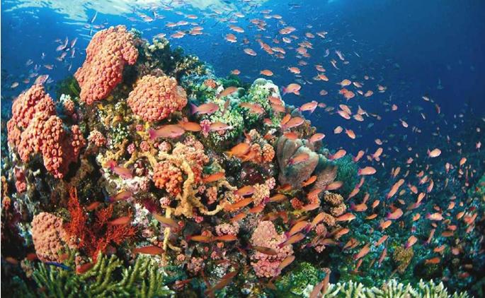
TUBBATAHA REEFS
by Popoy Castańeda
Tubbataha is a Samal word
meaning, a very long exposed reef. (the Samals are Islamic, sea-fearing
people from the Sulu archipelago who ranges beyond the southern
extremities of the Sulu Sea to fish). The reef is located at the
approximate center of the Sulu sea, 98 nautical miles 96 degrees southeast
of Bancao-bancao Point at the entrance of Puerto Princesa bay. The reef is
composed of 2 atoll reefs, the North Atoll and the South Atoll, separated
by a deep 6 nautical miles wide channel. The atolls are oriented on a
northeast to southwest axis. Both atolls are composed of a relatively
shallow lagoon completely surrounded by a narrow and shallow coral reef
platform that terminates into steep submarine cliffs on the seaward side,
plunging into depths of 40 to 80 fathoms. The west platform of the South
Atoll is exposed at low water accounting for the reefs Samal name.
The North Atoll is larger and longer, approximately 9 nautical miles long
and 3 nautical miles wide at its widest part. The smaller South Atoll is
roughly 5 nautical miles long, shaped like a pork chop widest at the north
at 2 to 3 nautical miles and terminating into the south tip where there is
a coral islet with a lighthouse.
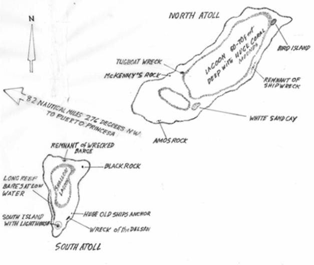
At the north-eastern end of the
North Atoll is a sand and coral cay, the North Islet more popularly called
Bird Island. It is a rookery for 3 species of seabirds, Boobies, the Brown
Booby Sula leucogaster, the Red-footed Booby Sula sula and the Masked
Booby Sula dactylatra (the North Islet is the only known rookery and
breeding site for the Masked Booby in the Philippines) Till the early
years of 1980, the North Islet was coral and rocks, bare of vegetation.
But in the mid 1980s, people from the Central Visayas attempted to settle
on the islet and cultivate seaweeds in the lagoon, they have since gone
but left the island overgrown with wild Euphorbia bushes and Ipil-ipil.
East opposite the Bird Island is a wide relatively wide sandy area
considered by foreign divers as the best in Tubattaha. Further south of
the North Islet along the east arm of the reef is a taller sand cay and
popularly called in the early days of diving in Tubattaha as Hongkong Cay.
It is now the site of the Marine Parks Ranger’s Headquarters.
At the south-western end of the north reef is an exposed triangular rock
popularly called Mckenny’s Rock named after the underwater filmmaker who
made a documentary promoting Tubattaha as an International Dive
destination. The rock marks the south-western end of a wide shallow sandy
area, which is one of the famous dive area in Tubattaha. Currently marking
the shallow eastern end of this area is the stranded wreck of the Malayan
tugboat “Pinoy”. It sits there on the reef seemingly on dry dock, at
present the once intact tugboat would have been reduced by the combined
effects of sea and weather. Midpoint on the east arm of the North Atoll
between North islet and the south east sand cay are scattered the debris
of an old shipwreck.
South across the channel is the
pork chop shaped South Atoll, whose most prominent surface feature is the
islet at the south tip where the light house is and planted with a few
coconut trees. Further up on the reef along the east arm of the South
Atoll is the stranded wreck of the Delsan II (or what is left of it at
present) and a few hundred feet north along the drop off edge is a huge
old fashioned ship’s anchor with a huge anchor chain hanging from it down
the drop off to excess of 100 feet depth. This huge old fashioned anchor
obviously does not belong to the Delsan II wreck. Going north along the
reef, the drop off edge current is always experienced by divers in this
area. Proceeding north from the shallow drop off lip you will arrive at a
wide relatively shallow sandy area with huge coral mounds and low profile
coral patches this area is marked on the reef’s shallow part by Black Rock
which also marks the northeast point of the South Atoll. This wide sandy
area is a safe anchorage when there is a strong south-westerly wind
blowing. Proceeding northwest, rounding the northeast point past Black
Rock is the South Atoll’s north face, where approximately near the center
is the wreck of a barge where during the early days of diving in Tubbataha,
we used to anchor by using the mooring post of the wreckage.
At the western platform of the South Atoll is the long narrow reef exposed
at low tide, that the whole reef system Tubattaha was named after by the
seagoing Samals who used to range this far north of the Sulu sea from
their territory in the Sulu Archipelago. Tubattaha Reef has an estimated
area (that enclosed by the coral platforms and the lagoons within) at 40
square kilometres. Roughly the distance between the North Islet or Bird
Island in the north atoll to the Lighthouse at the South Atoll is 17 to 18
nautical miles if you are at the North Islet you cannot see the Lighthouse
because it is below the curve of the horizon.
Anchorage at Tubbataha is very precarious especially for vessels more than
100 feet long and with drafts of more than 16 feet. Anchorages even at the
mooring buoys provided by the Park are precarious with limited swinging
room. During the survey of Tubbataha by the DENR Marine Park Task force in
the summer of 1982 the Bureau of Fisheries Trawler “SABALO” was used by
the survey team. The survey vessel anchored safely and securely by using
its 1 inch trawling cable to anchor at the base of the reef’s wall at 70
fathoms and even then we were just less than 200 feet away from the
shallows of the reef’s drop off edge.
Anchoring in the area is even made more difficult by the swift tidal rips
in the reef which is influenced by the reefs physiography and the
prevailing monsoon and where at times the current is very swift, erratic
in direction and comes in surges especially on the south and northwest
point of the South Atoll and the and the northwest and northeast point of
the North Atoll the northeast point of which is most notorious and likened
by divers to diving in a washing machine.
Currently the only navigational aid at this immense reef is the
Lighthouse. There are buoys installed by the Marine Parks but only to mark
specific anchorage sites. The precise location of this big reef is still
debatable.
Tubattaha Reef is a veritable
graveyard of ships attesting to the fact are the wrecks and remnant of
wrecks scattered around the reef. In the early days of diving the live
aboard dive boats operating in the area experienced a lot of
groundings, but then, the dive boats were smaller and lighter and were
able to extricate themselves with minimal damage to the reefs and to
themselves. In 1998 the research vessel of the DENR, RV Explorer, ran
aground on the reef but was fortunate enough to extricate itself with just
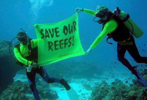
embarrassments for the captain. Two years ago the Green Peace Rainbow
Warrior ran aground on the reef and paid a fine. I myself had ran aground
on the reef about 5 times, of course I was not the captain of the boat
although we both got bawled out by the boat’s owner.
Recreational diving was opened in Tubattaha by the Aquaventures Diveboat.
In those days each boat was provided with armed escorts by the WESCOM
(Western Command). In 1982, Brod Arnold Caoili ASEC of DENR, who
headed the Task Force Pawikan and the Marine Park Task Force and a
Certified SCUBA diver, authorized the biological survey of Tubattaha Reef
preparatory for it being declared a Marine Protected Area. The survey
party composed of marine biologists and support divers from the Bureau of
Fisheries Coral Reef Project and the UP Marine Science Institute on board
the BFAR Trawler Sabalo, conducted the survey in 6 weeks (incidentally the
leader of the survey party happened to be a Betan.)
Tubattaha was eventually declared a Marine protected area by the DENR.
Later the actual management was transferred to the WWF. Currently the reef
enjoys status as a Natural Heritage Site of UNESCO. It is also a part of
Palawan’s Environmentally Critical Areas Network and a core area of
Palawan Man and the Biosphere a plan formulated by Brod Delfin Ganapin Jr.
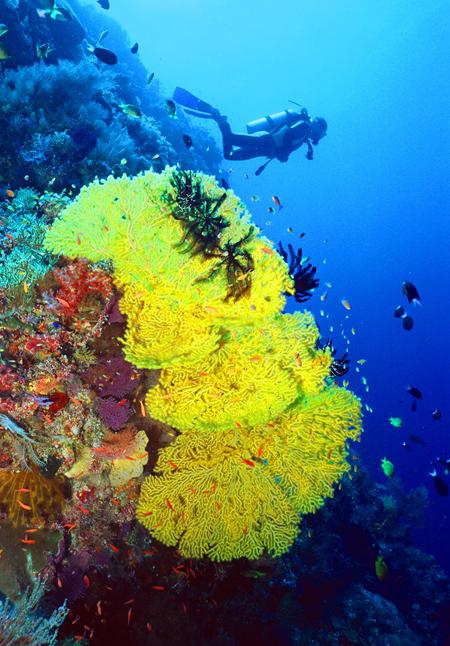
Tubattaha reef is also a prime dive destination in this part of the world
with dive boats booked a year ahead with dive boats getting bigger
carrying more passenger divers. Now the Marine park has a problem in
anchoring the bigger boats since the bigger vessel tends to drag out the
anchor blocks set up by the Marine Park.
Three years ago Tubattaha Reef was in the media limelight when private
groups advocated for Tubattaha to be the 8th wonder of the world.
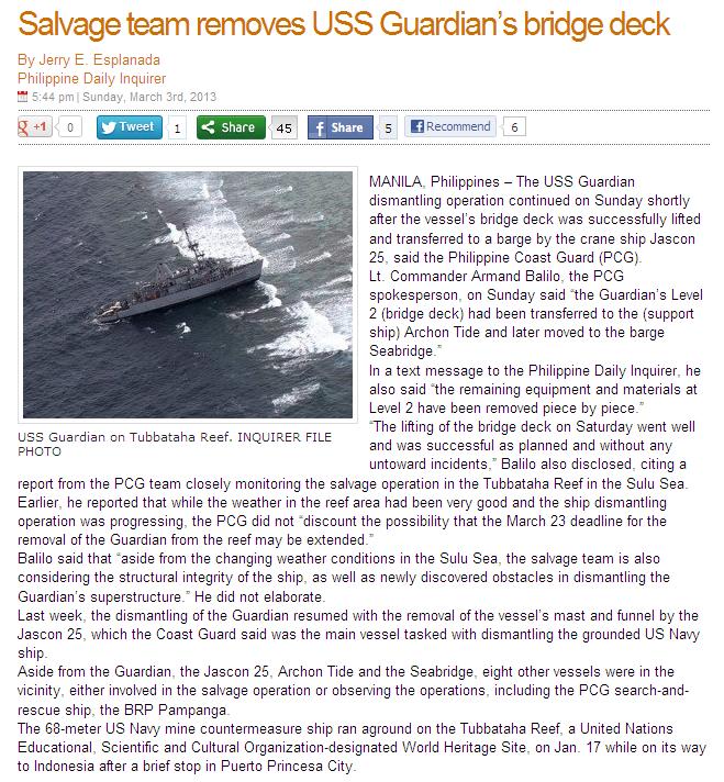
Now Tubattaha is again the center
of a media hype. On January 17 a U.S. naval patrol vessel ran aground
the South Atoll of Tubattaha Reef. Since then the reef has been the
subject of TV interviews, talk shows, Facebook and Twitter. Some militants
even reacted by demonstrating in front of the US embassy condemning the
Americans for being there and just anywhere.
It is claimed and stated by the management of Tubattaha that the damage is
equivalent to 5 basketball courts and that the damage would take a hundred
years for the reef to recover. It is also stated that the damage would
affect the fishery production of the surrounding areas. This is the stance
of the management of Tubattaha and nobody has said otherwise. Now the
public is convinced that it will take 100 years for it to recover if it
will recover at all.
=============================================================================================
Source: globalnation.inquiry.net
=============================================================================================
However, corals are not the slow growing marine animals as known before.
It has been found that some fast growing species can grow I inch annually.
I have seen the reefs of Cabilao island swept clean off the reef by storm
waves barely 18 years ago and the reef now is a favourite dive site in
Bohol. We have seen the corals of Apo Reef Island damaged by the combined
efforts of dynamite and cyanide fishermen and storm waves regenerate in 16
years (Apo Reef is now a Marine Protected Area and a tourist dive
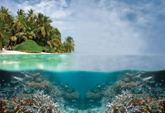
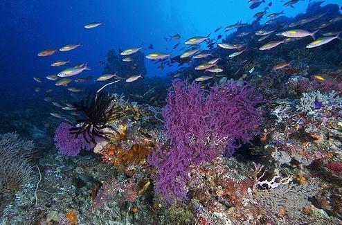
destination). Tubattaha being in the center of the Sulu sea is free of the
pollution and siltation suffered by near shore reefs. It is a very healthy
reef which is one of the criteria it satisfied when it was made a Natural
Heritage Site.
For the ship that size to incur this area and extent of damage it would
have to be tossed about and dragged by the waves across the reef and by
this time the ship would be a total wreck beyond salvaging. But the vessel
is upright like many of the grounding I saw and experienced.
It is also claimed that this incident will affect the fishery production
of the surrounding area. Granting the damage is equivalent to I hectare or
10,000 square meters this would be minimal to a reef that has an estimated
area of 40 square kilometres.
Although the damage is minimal the United States Navy will have to pay for
the damage. The U.S. Navy paid 54 million dollars to the city of Oahu in
Hawaii when one of their ship grounded on the reef on the entrance to
Pearl Harbor. It was also the U.S. who initiated this system of paying for
damages incurred on coral reefs. To end all of this speculation UNESCO is
sending its own team to assess the damage.
Currently at the time of writing of this work, there is talk being bandied
around in the media about reef restoration which means the transplanting
of corals, to be spearheaded by DOST. This process is still in the
experimental stage and in Tubattaha would do more harm than good. But
everybody both government and the diving community have jumped in the
bandwagon and every diver would like to get their feet wet for various
reasons.
The best thing for the Government to do is let Tubattaha reef heal itself,
cordon off the damaged area with a sufficient buffer zone and prohibit
human intrusion. Anyway the Dive Visitor season at Tubattaha is 3 months
and 2 weeks at the longest, from March to May and a week or two of June if
you are lucky. If not you get caught by the early typhoon. The rest of the
year the typhoons and the monsoons render tourist diving operation in the
reef dangerous. We shudder at the idea of divers and amateur marine
biologist stumbling around the reef cutting the intact coral beds to
replant the damaged area. The money which would be paid for the reefs’
damage is best spent in putting more navigational aids in the reef, better
radar and communication equipment and a patrol boat similar to the type
used in great Britain for life saving work Those crafts are fast stable in
extreme weather and shallow draft to be able to enter the north lagoon for
shelter in times of extreme inclement weather.
(Back --->
Environmental Awareness)
(Back ---> Current Features)
|