

Travelogue
Our Balkan Adventure: Part One
by Willlie Vergara
AN IMPORTANT TRAVEL TIP: Before this trip, I bought a new camera that has
lots of features. It turned out, however, that some pictures here may not pass
the standard of the more advanced photographers because of incorrect setting.
Lesson learned: Test your new camera first before using it for important events.
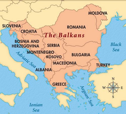
The Balkan Peninsula is surrounded by the Adriatic Sea to the west, the
Mediterranean Sea (including the Ionian and Aegean seas) and the Marmara Sea to
the south and the Black Sea to the east. Its northern boundary is the Danube, Sava and Kupa Rivers.
The population of the Balkan countries put together is less than a third of the population of the Philippines. The most populated is Serbia with 7 million and the smallest one is Montenegro with over than 0.6 million. Total land area combined is about 400,000 sq km, almost about the size of the State of California, USA, just 1.3 times bigger than the Philippines.
Balkan Landscape
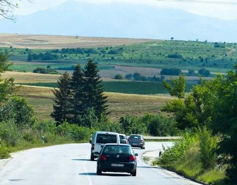
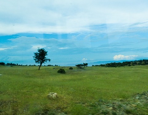
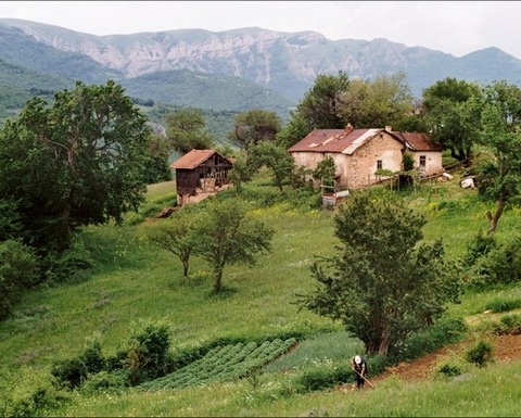
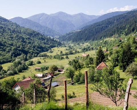
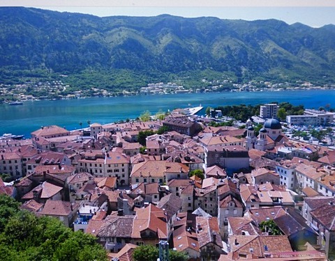
Spectacular as the landscape truly is as can be seen in the above photographs, the Balkans seem to be indescribably complicated. History of the Balkans dates back to the Neolithic and Paleolithic era and are the route by which farming from the Middle East spread to Europe during the 7th century BC. Early settlers are the Illyrians (along the coast of the Adriatic) and the Thracians (inland). Most of the inhabitants belong to the Southern Slavs. It has a long history of wars and conquests.
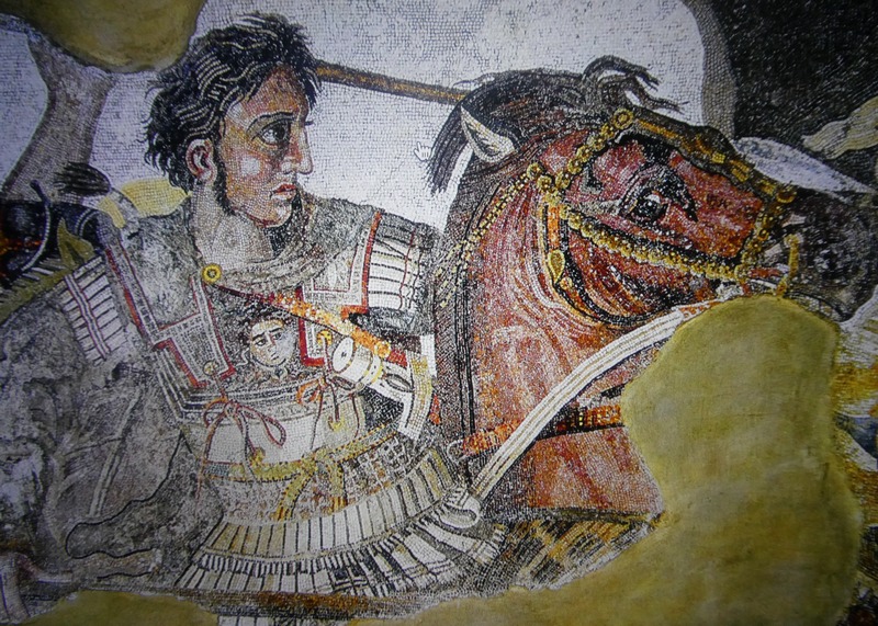
Alexander the Great
Many of the regions
were conquered by the Greeks – through Alexander the Great of Macedonia and his
father King Philip II in mid-300 BC. After this era, the Byzantine Romans came,
but for several centuries, the Balkan people were part of the conquests and wars
with the Ottomans then the Austro-Hungarian empires up to the 19th and 20th
centuries. Many of the Balkan countries are quite “young” – Greece in 1821,
Serbia, Montenegro in 1878, Bulgaria in 1908, and Albania in 1912.
The
First Balkan War broke out when Bulgaria, Serbia, Greece and Montenegro allied,
and ended the Ottoman Empire in 1912-1913. The First World War also started
here, and will be discussed later when we get to the topic of Bosnia and
Herzegovina. At the time, most the countries were governed by their respective
monarchies.
With the exception of Greece, all Balkan countries
were allies of Nazi Germany and Fascist Italy being part of the Axis. After the
much storied failed attempt by Nazi Germany into Russia, many Balkan countries
allied with communist Russia to drive out the Nazis.
(l hope the ardent
reader is still following!)
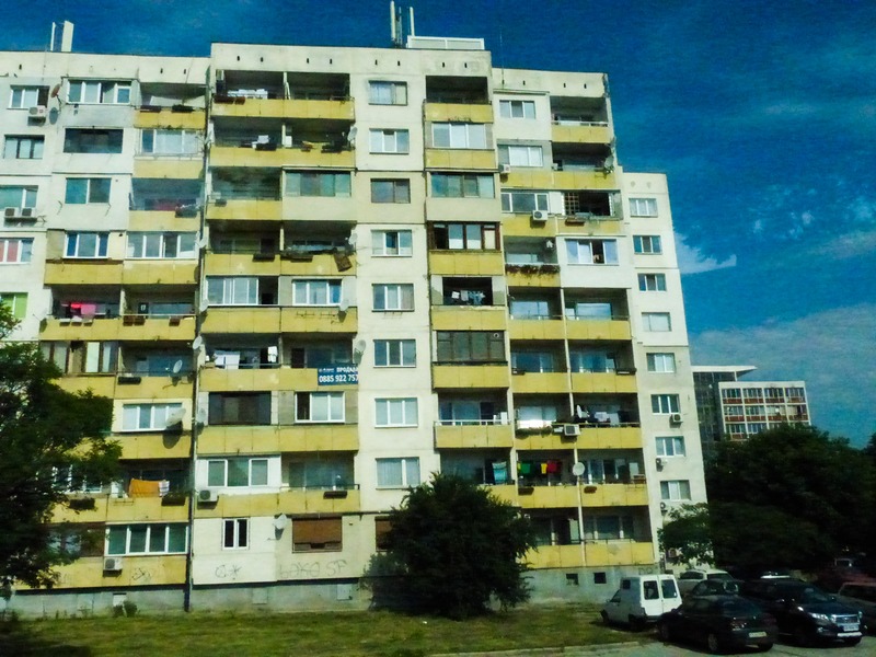
Communist housing such as this can be seen in all
the Balkan countries.
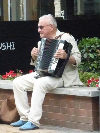
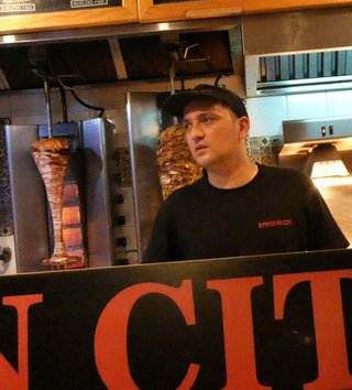
Among South Slavs, it is not easy to tell which country they come from. From top, left to right: Bulgarian, Croatian, Bosnian, Macedonian, Albanian and Serbian.
Major ethnicity in the Balkans are South Slavs. Most of the countries here have closely related languages and can understand each. Many countries here share so much history. They were under various emperors, Zoltans (Ottomans), missionaries, bishops and were targets of Nazi and Italian Fascist invasions and later on embraced the communist ideology.
Most of these countries use the Cyrillic alphabet just like the Russians. The countries of Croatia, Bosnia and Herzegovina, Slovenia, Montenegro, part of Serbia. Most of central and northern Albania) are descendants of the Illyrians (Indo-Europeans in antiquity). The others are mostly descendants of the Thracians. (The gladiator Spartacus was a Thracian, remember?)
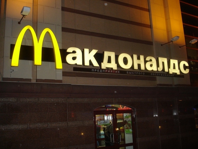
“McDonalds” in Cyrillic alphabet
Catholic Church
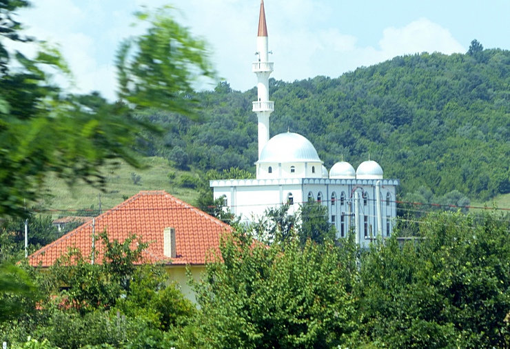
Moslem Mosque
Orthodox Church
In the midst of all these similarities, there is
so much ethnic baggage among themselves. They adopted different religions and
this was one of the major causes of their ethnic divide, aside from nationalism.
Another major cause is their natural borders – mountain ranges, rivers, lakes.
Catholic South Slavs are called Croats. Orthodox Christian South Slavs are
called Serbs. Moslem South Slavs are called Bosniaks. When one puts them side by
side, it is extremely difficult to identify one from the other.
Going back some years, the assassination of Archduke Franz Ferdinand in the Balkan city of Sarajevo provided the Austro-Hungarian government with a pretext for crushing Serbian nationalism, something it had long desired. This assassination started The First World War.
The Balkan story would not be complete without the
emergence of a strong, charismatic leader that created Yugoslavia. That name is
Josip Broz, aka Marshal Tito, Yoguslav communist revolutionary leader –
authoritarian but considered as a benevolent dictator, and is viewed as a
unifying symbol of the states that comprised Yugoslavia: Serbia, Croatia,
Montenegro, Bosnia, Slovenia and Macedonia. He maintained peace among the
states. He respected all the diversity of the Balkan people and was leader of
the non-aligned nations along with Nehru of India, Nasser of Egypt and Sukarno of
Indonesia. In office from 1953 up to his death in 1980. He abandoned Stalin and
put up his own model of market socialism where firms were socially owned by
employees and structured on workers’ self-management.
While peace in
Yugoslavia existed during his reign, there was only one Marshal Tito. Five years
after his death, the country crumbled and gave way to wars of independence. What
happened after that will be discussed as we go along.
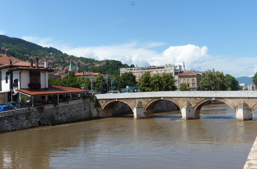
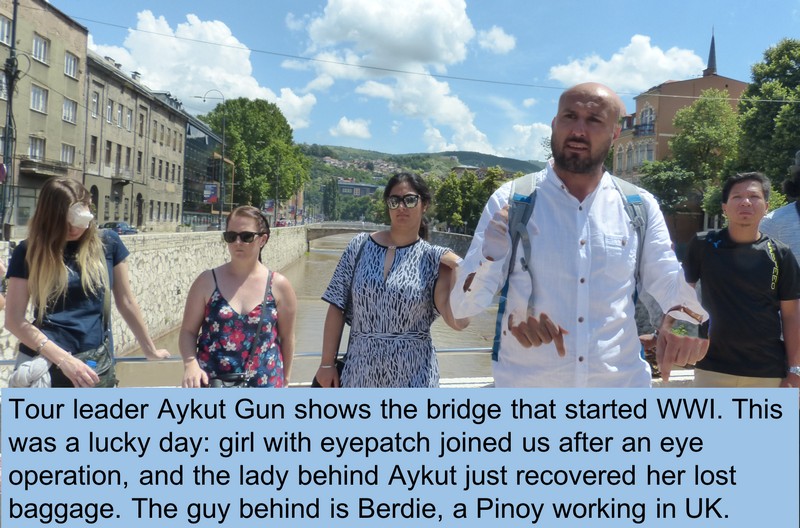
World War I started on this bridge.
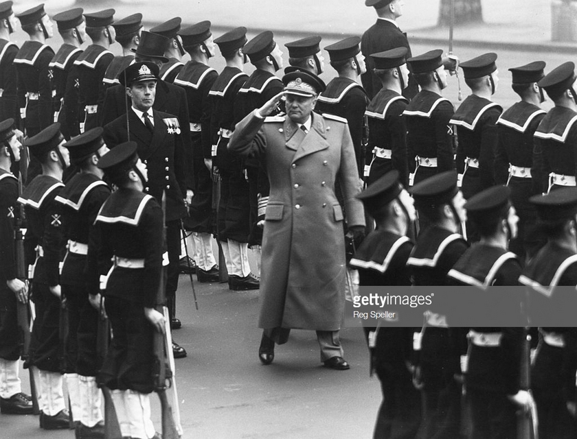
Marshall Tito ruled a united Yugoslavia for more
than two decades.
1. SERBIA
Serbia is a country with northern plateaus and mountains with ski resorts. Capital city Belgrade is home to Communist-era architecture and Kalemegdan Park, site of Belgrade Fortress. It was occupied successively by the Roman, Byzantine and Ottoman empires.
The City of Belgrade suffered bombings by the US and UK in 1998-1999, which is believed to have stopped the “ethnic cleansing” during the Kosovo War. Remains of this bombing are still seen at a certain part of Belgrade.
Norman (after five days in Ljubljana and Zagreb) and I arrived at B
Hotels in Belgrade on the same day, stayed there for two nights, and we had our fill of
Serbian food at a nearby, newly opened restaurant.
The formal tour would start in the afternoon of the next day, so we maximized our day seeing parts of Belgrade on our own. Using public transportation around the city, we weren’t even charged anything for the bus and tram rides! That’s because cash weren’t accepted by the drivers. Only tickets. From the Belgrade Central train station we took a tram towards the Church of Saint Sava, one of Belgrade’s major sites.
1.1 Belgrade
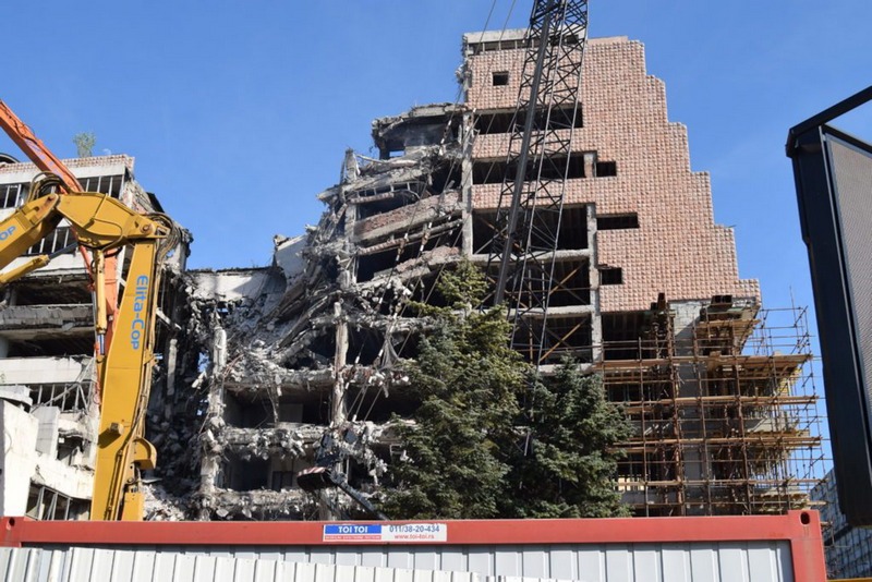
Bombing in Belgrade from NATO air strikes in 1999
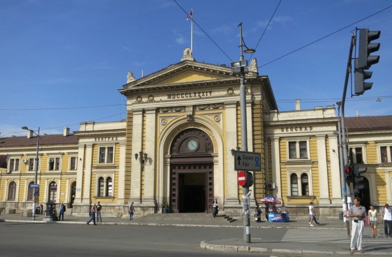
Belgrade Central Station
Downtown Belgrade
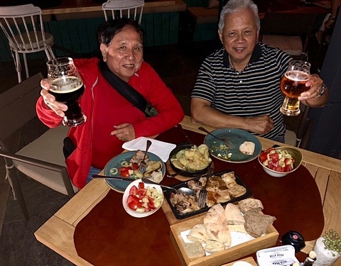
After checking in at B Hotels, we celebrate our first night with Serbian food and wine at newly opened Restoran Bela Reka.
The Church of Saint
Sava is one of the largest Orthodox churches in the world. It was built in honor
of St Sava (1175-1236), the first Archbishop of the Serbian Orthodox Church. Born into royalty in the late 12th century, Rastko Nemanjić gave up his
crown as a teenager in favor of a life of simplicity and service. He escaped at
night to Greece’s Mt. Athos, where he became a monk, took the name Sava, and
dedicated his life to the growth of the Serbian Orthodox Church.
With a
story that rivals famously incomplete Sagrada Família in Barcelona, St. Sava
Temple is an eternal work-in-progress—one that’s existed in various stages of
creation for more than 100 years. However, the crypt located underground is truly worth seeing. The
mosaic artwork is one of the largest and most expensive in the world. It was
really fortunate for us to go on our own as this was not part of the tour
group’s itinerary.
Church of Saint Sava
We had to go back to the
hotel in time for a briefing by Aykut Gun, our tour leader. In that briefing, we
found that we were a very big group – as many as 47 at some points of the trip.
Without Norman and me, average age of the group is about 30 or so, mostly single
ladies and dudes. At night, we had a city tour of Belgrade where we had dinner
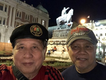
and free time to walk at the downtown area. Republic Square is at the heart of
Belgrade surrounded by National Museum and National Theatre. The square has lots
of shops, places to dine or grab a beer. We chose the Gyros Restaurant and ate
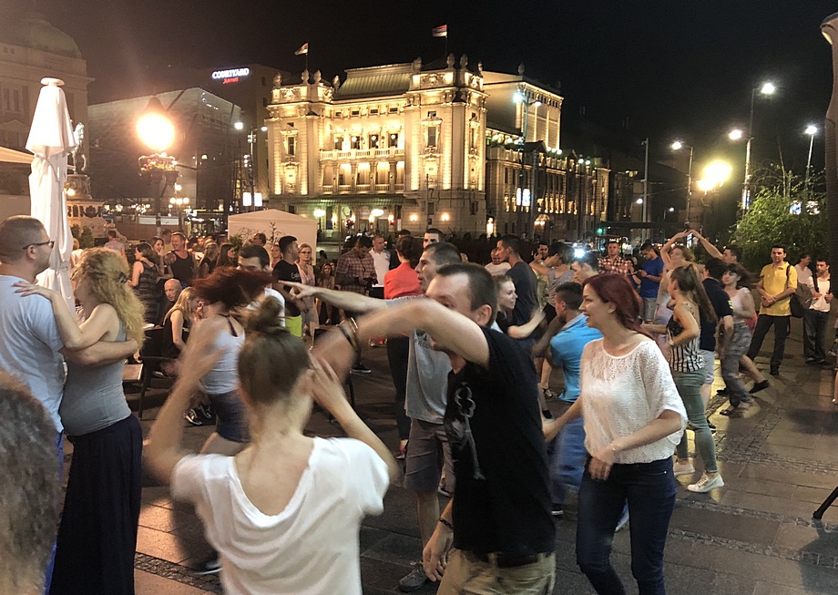
delicious Serbian food at very reasonable prices. Here, we saw
people dancing salsa in the streets with blaring music coming from the corner Latin bistro
- and Norman video’d me dancing too! Knez
Mihailova is Belgrade’s main city street with lots of shops and cafes. We went
here on our first night, and went back there the next morning. This is great
place just to take a walk, enjoy the architecture, watch people, and window
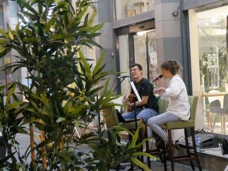
shop. Quite a romantic place, with only foot traffic here with various shops,
restaurants, money changers and street entertainers.
Republic Square
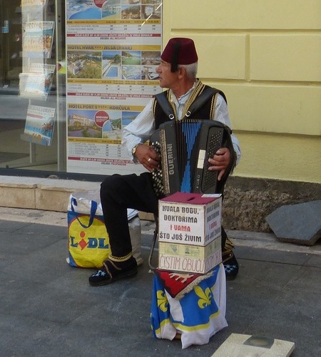
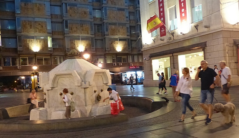
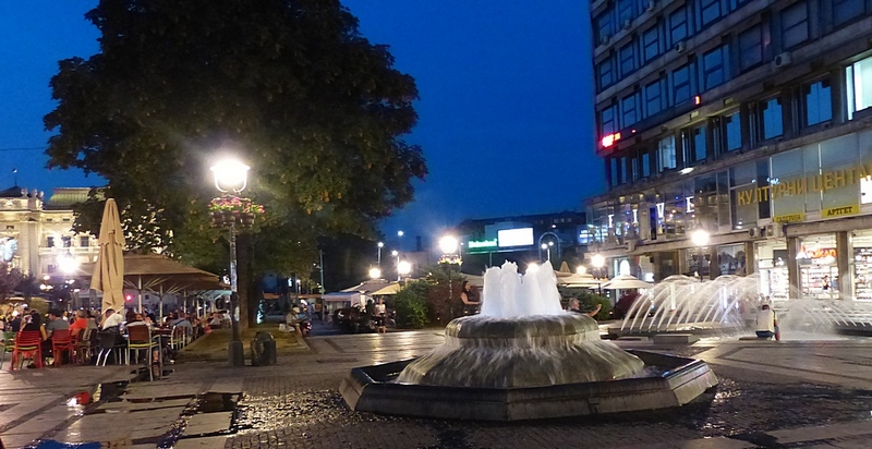
The following day after breakfast, we proceeded to
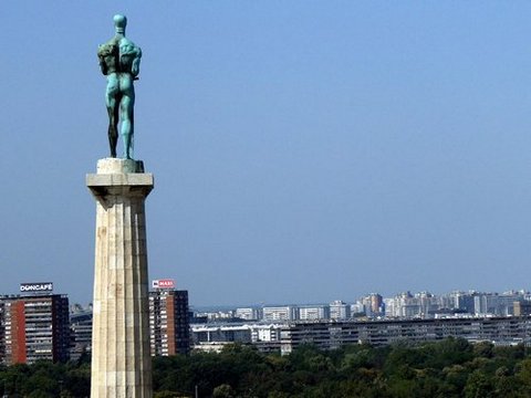
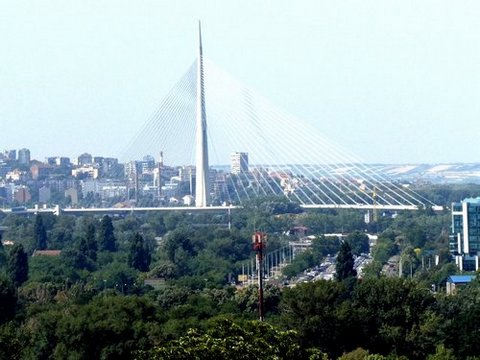
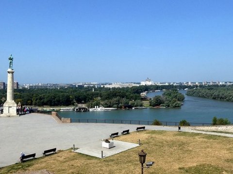
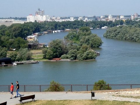
Belgrade Fortress featuring an old citadel and Kalemegdan Park – a most major
tourist destination in Serbia. It sits on the confluence of the River Sava and
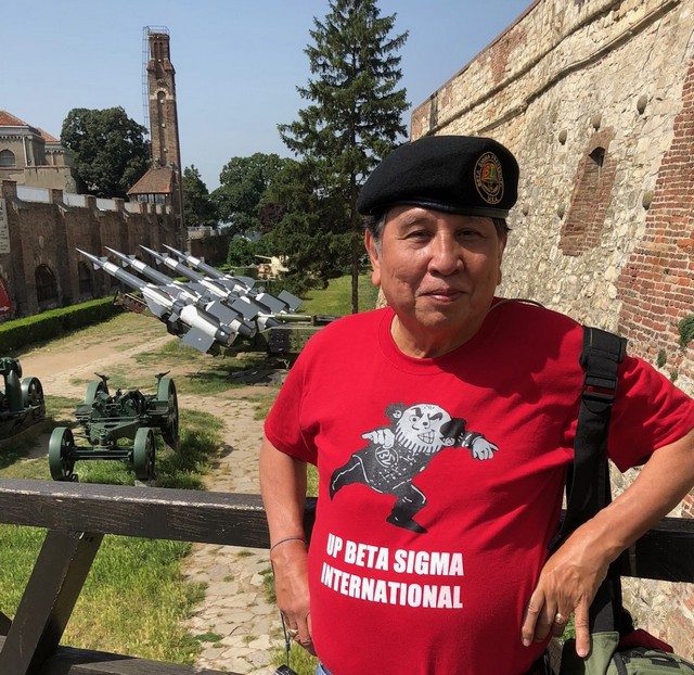
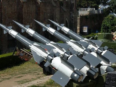
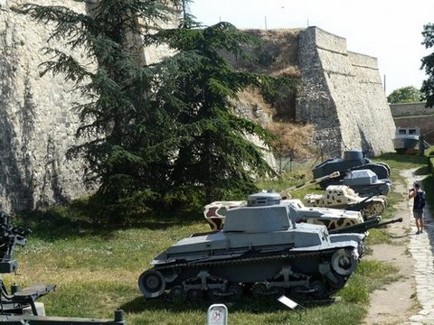
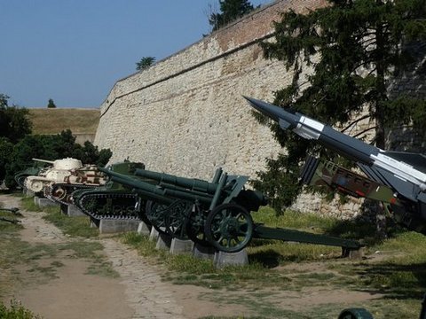
Danube. It is right on an urban area of modern Belgrade. By the gate of the fortress are war materiel – tanks,
missile launchers, cannons – used during their recent wars.
This fortress
was declared a Monument of Culture of Exceptional Importance. Admission is free.
It attracts over 2 million yearly and nominated for the UNESCO World Heritage
Site. Kalemegdan boasts of its shaded benches, picturesque fountains,
statues, historical architecture and scenic river of the confluence between the
Sava River and the famous Danube. Belgrade Fortress is known for its
kilometers-long tunnels, underground corridors and catacombs. It was founded
in the 3rd century BC by the Celts, who had defeated Thracian and Dacian tribes
that previously lived in and around the fort. The city-fortress was later
conquered by the Romans but was repeatedly destroyed in the invasions by the
Goths and the Huns.
The name Belgrade (or Beograd in Serbian), means a
"white town" or a "white fortress". The fortress kept changing its masters:
Bulgaria during three centuries, and then the Byzantines and then again
Bulgarians. The fortress remained a Byzantine stronghold until the 12th century
when it fell in the hands of the newly emerging Serbian state. The Hungarian
king Béla I gave the fortress to Serbia in the 11th century as a wedding gift
(his son married the Serbian princess Jelena), but it remained effectively part
of Hungary. In 1521, the fortress was conquered by the Turks and
remained under the rule of the Ottoman Empire until the year 1867. After almost
two millennia of continuous sieges, it is now known as Kalemegdan Park derives
from two Turkish words, kale (fortress) and meydan (battlefield) literally, a
battlefield fortress.
After a few more hours at the Knez Mihailova, we set out for the country of Bosnia and Herzegovina.
Belgrade Fortress
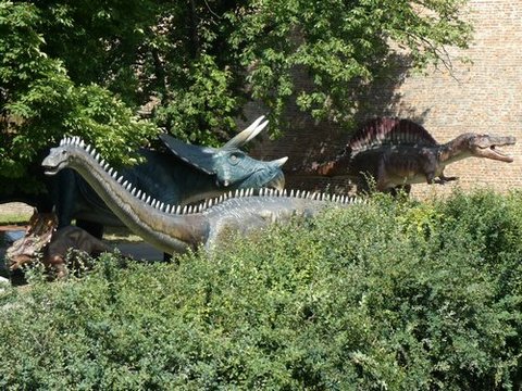
2. BOSNIA and HERZEGOVINA
Of all the Balkan countries, Bosnia and Herzegovina has the most complicated history. Bosnia and Herzegovina is a country of the former Yugoslavia’s crossroad of cultures and has a population of almost 4 million. Here, Catholic Croats (14%), Orthodox Serbs (38%) and Moslem Bosniaks (48%) – all come together. There are three official languages: Croatian, Bosnian, Serbian.
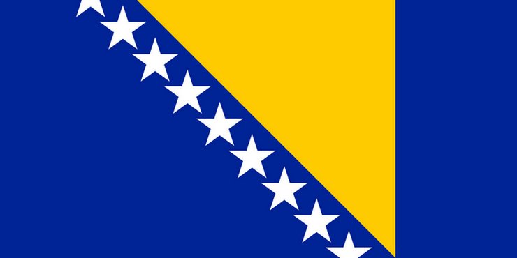
The flag tells an interesting story. The yellow triangle represents the three ethnic groups: Bosnians, Serbs and Croats. It is a triangle also because country looks like a triangle. The stars represent their desire for a never-ending affiliation with the European Union. Bosnia has a three-member presidency: Serbs, Croats and Bosnians, something really unique from the rest of world. However, the state governments are highly decentralized. My son-in-law who comes from the Balkans says that they have a rotating presidency. “Whatever works,” as Americans would say.
After crossing the border, we stopped over at the town of Vlasenica, along the Sava River dividing Serbia and Bosnia between a 9-hour trip. Since our bus was longer than the ordinary, it took the driver longer to negotiate the zig-zag roads.
This is the border town of Vlasenica in Republika Srpska, an entity of Bosnia, along the Sava River that separates Serbia and Bosnia.
At a roadside restaurant ("Pectopah" on the sign board), instead of a pig lechon, Balkans have a "sheep lechon" roasting on the outside grill pit.
The country has two autonomous entities: the Federation of Bosnia and Herzegovina
and Republika Srpska, with a third region, the Brčko District, autonomously
governed under local government.
Sarajevo had its glorious moments In
1984, the venue of the Winter Olympics. However, the structures are now in a bad
state of disrepair, but nonetheless remains a popular tourist site. Too bad we
were not brought here.
Following the dissolution of Yugoslavia, the republic proclaimed independence in
1992, which was followed by the Bosnian War that lasted until late 1995. Bosnia
was ripped apart in a three-way war between these groups. They agreed to a Peace
accord in 1995. They had to create a semi-autonomous regions within the state to
preserve the balance.
This country has deep history in
alliances and enmities. CAUTION: When you meet someone who comes from Bosnia,
don’t rush to call him a “Bosnian” because you may be less than 50% correct!
Bosnia is bordered by Croatia to the north and west; Serbia to the east;
Montenegro to the southeast; and the Adriatic Sea to the south, with a coastline
about 12 miles long. In the central and eastern interior of the country the
geography is mountainous, in the northwest it is hilly, and the northeast is
predominantly flat land. The inland, Bosnia, has a moderate continental climate,
with hot summers and cold and snowy winters. The southern tip, Herzegovina, has
a Mediterranean climate. Half the country is forested. Much of its arable lands
are, however, still full of landmines.
Having
been part of the Ottoman empire for centuries, Islam is the religious majority.
The Bosnian Serbs must be the whitest Muslims in the world, according to a
geography expert.
Today, Bosnia is one of the most frequently visited
countries in the region, projected to have the third highest tourism growth rate
in the world between 1995 and 2020. Its cultural heritage is inherited from six
historical civilizations, its cuisine, winter sports, its eclectic and unique
music, architecture and its festivals.
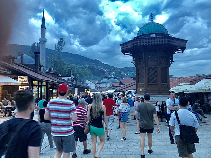
We arrived in Sarajevo before
sunset, passing the bridge where the WWI started. We immediately went to the old
town, a lively place teeming with tourists, especially that it was the end of
Ramadan where most locals were going to eateries.
We lodged at Hotel Exclusive in Sarajevo - very spacious with a spectacular view, an exquisite dining room, and a great breakfast that was typical in ALL of the hotels during the tour.
2.1 Sarajevo
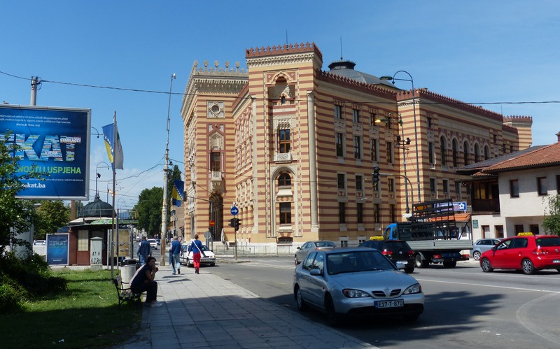
The national capital is Sarajevo and has a well preserved old quarters.
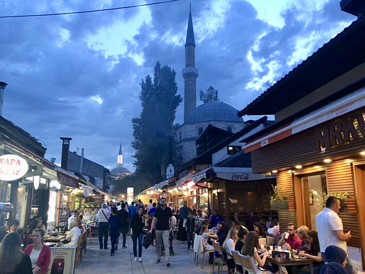
Old Town
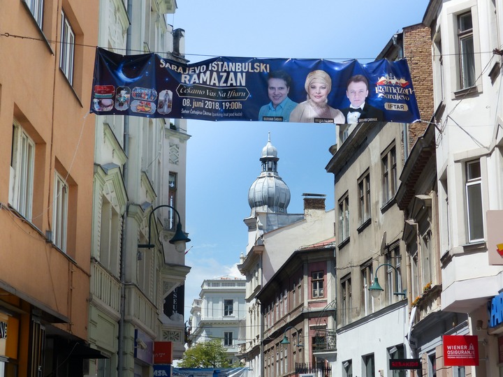
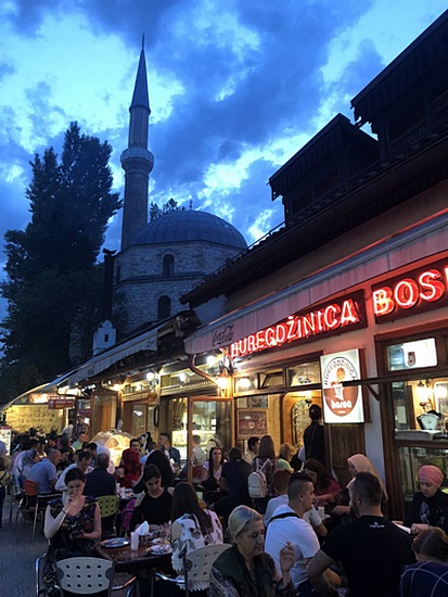
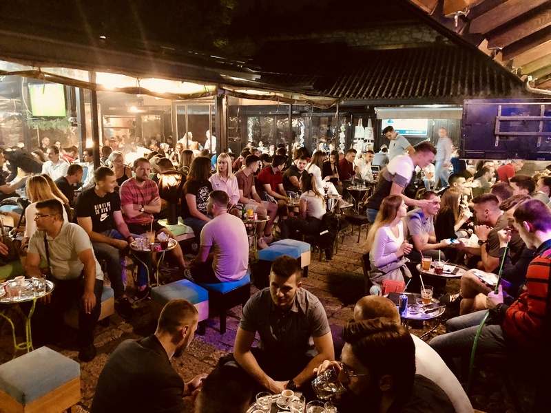
Breaking the fast on Ramadan
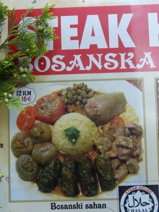
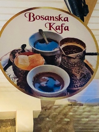
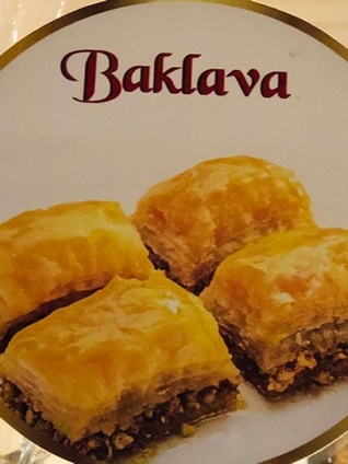
Balkan delights
Hotel Exclusive, Sarajevo
In the morning, we were brought to
one of the most memorable sites of this tour – the Tunnel of Hope that also
features a museum inside a house peppered with bullet holes. Behind it is an
underground tunnel constructed in 1993 during the Siege of Sarajevo in the midst
of the Bosnian War. It was built by the Bosnian Army in order to link the city
of Sarajevo, which was entirely cut off by Serbian forces, with Bosnian-held
territory on the other side of the Sarajevo Airport, an area controlled by the
United Nations. The tunnel also linked the Sarajevo neighborhoods, allowing
food, war supplies, and humanitarian aid to come into the city, and allowing
people to get out. The tunnel became a major way of bypassing the international
arms embargo and providing the city defenders with weaponry.
Sarejevo suffered the longest siege of a city in
modern times - 1,425 days.
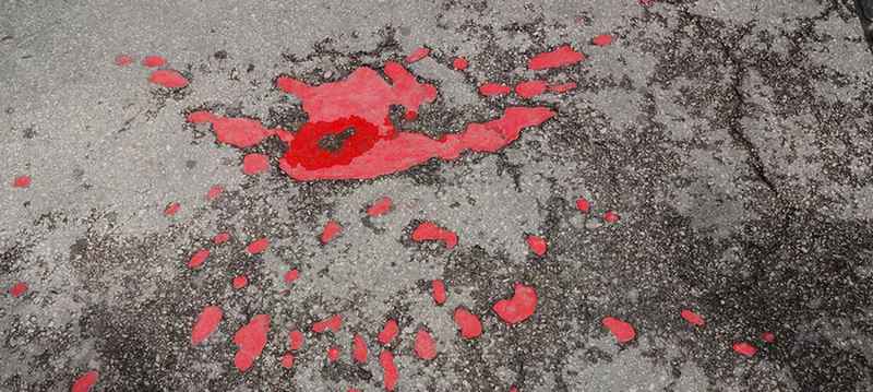
"Sarajevo Rose"
These "roses" could be seen around the city of Sarajevo, showing where bombs were dropped during the siege.
Tunnel was dug across the field to the airport
From there, we drove back to the Old Town,
where we had a better look at the Latin Bridge where Archduke Franz Ferdinand
along with his wife Sophie were assassinated by a Serbian extreme nationalist.
Austro-Hungary blamed Serbia and allied nations jumped in to support both sides
and World War I officially began. Today, you can safely walk across the Latin
Bridge, built in the 1550s by the Ottoman Empire, and see the marker noting the
exact location of the assassination.
The brief walk towards the Old Town almost spoiled the
tour, not only for me but perhaps for the rest of the tour group. Three
well-dressed women got into our group and stole a small bag inside my camera bag
that included my passport, credit and debit cards and driver's license. By some
miracle, and perhaps because they did not find any cash, everything was returned
by one of these three ladies, claiming that “she found it on the street”.
As part of the story,
things went well within the tour group. First, the two girls whose traveling
bags were misplaced by the airline were recovered and a courier traveled across
cities to return them to the owners. Second, the girl who had to undergo an eye
operation thereby delaying our early morning departure from the hotel finally
caught up with us. Third, my lost-and-found bag as mentioned.
We saw Old
Town Sarajevo again at daytime – visited a mosque, had a sumptuous Balkan lunch,
and walked around to see more sites.
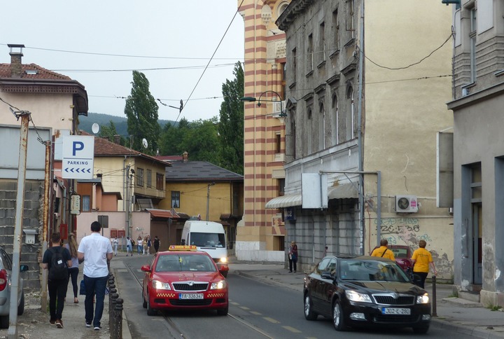
Site of pickpocket incident
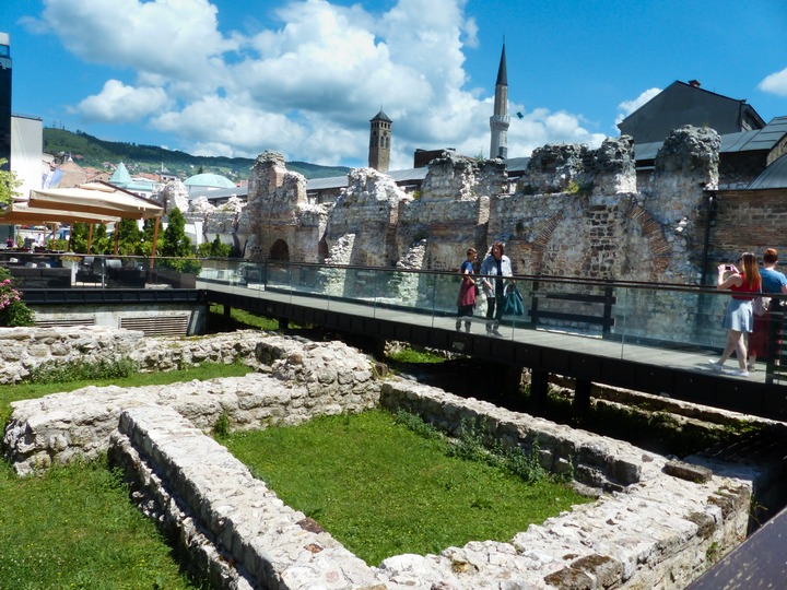
Roman ruins
Canadian bikers line up on Latin Bridge for a bikeathon.
Latin Bridge is where Archduke Franz Ferdinand was assassinated in 1914 that ignited World War I.
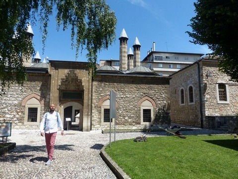
Muslim mosque and Catholic Cathedral in Sarajevo
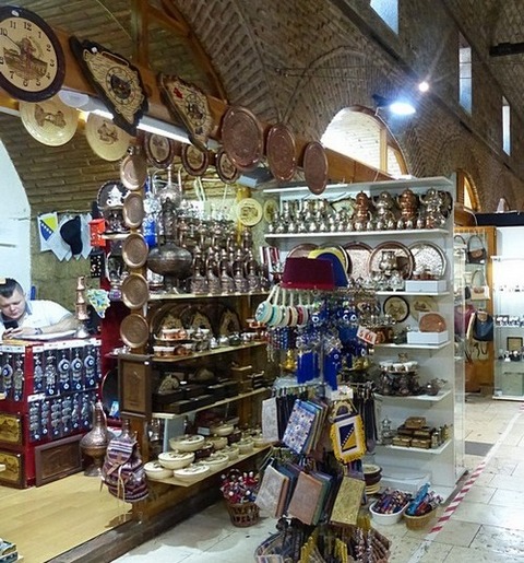
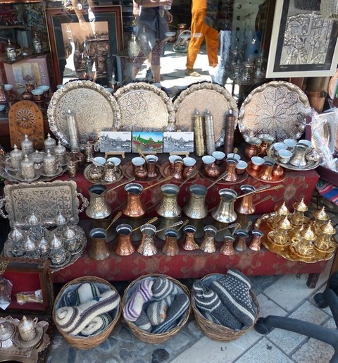
Sarajevo craftsmen produce authentic quality copper items testifying to the handicraft tradition of nearly 500 years. Bill Clinton bought items here.
2.2 Mostar
From Sarajevo, we went on a 2-hour bus trip to the now very famous Mostar at Herzegovina. Mostar is also called the little Istanbul because, until the 20th century, it was under occupation of the Ottoman Empire. When the Ottomans vacated, they left behind a large Moslem population.
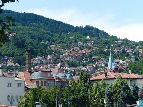
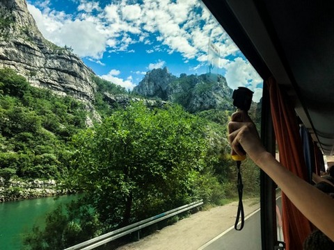
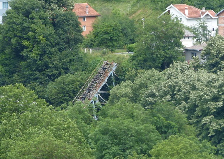
Nazi bombed bridge in World War II
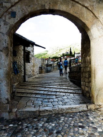
Mostar Bridge (Stari Most), a marble hump-backed bridge considered as an examplary
piece of Balkan Islamic architecture, was commissioned in 1557 by the great Sultan Suleiman.
It took nine years to complete
symbolizing where East meets West in Europe. The bridge, 30 meters long and 4
meters wide, stood for 427 years until it was destroyed on November 9, 1993 by
Croat military forces during the Croat–Bosniak War. The bridge was re-built with
local materials and Ottoman construction techniques in June 2001 and was
inaugurated in July 2004 with the cost estimated to be 15.5 million US dollars. My non-slip shoes would not work on
the very slippery surface of the bridge. That is perhaps the reason why safety
marble barriers were constructed on the top of the bridge.
Mostar Bridge
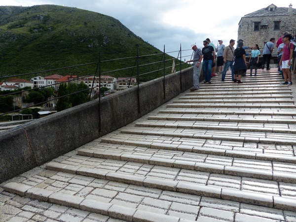
Caution: very slippery marble
Everything happens on the bridge. A guy proposed marriage at the topmost part of the bridge. Unfortunately, the pic below does not adequately tell the story that begins with a young man genuflecting before his fiancée and offering her an engagement ring. Then there are divers who jump 25 meters high towards the Neretva River for 25 euro. It is said that some divers have died jumping. On top of the bridge, divers take money before taking a 75-ft jump into the river. Norman patiently waited for a diver so he could take some pictures, while some in our group went for a swim at the cold waters of the scenic Neretva River.
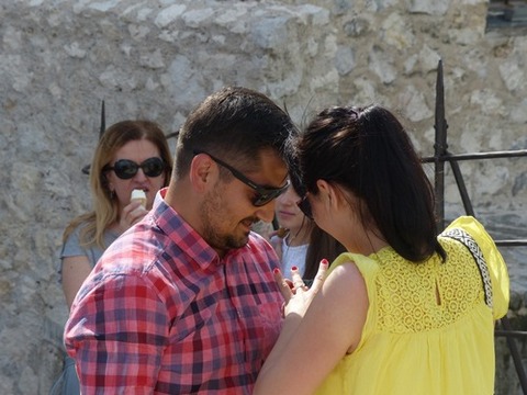
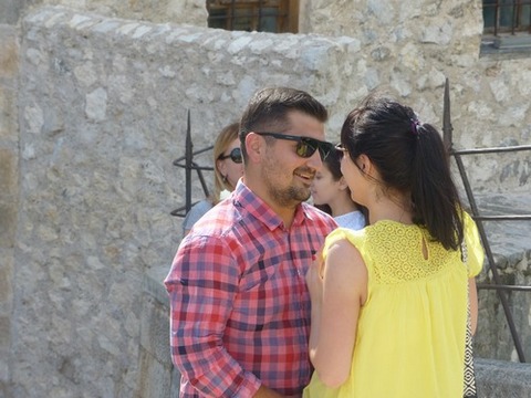
A marriage proposal on Mostar Bridge
Our tour mates who went for a dip told us the water was quite chilly.
Balkaneers pose for a goup picture at Coppersmith Street with many colorful shops selling souvenirs, including gun and cannon shells from the war.
Divers prepare for the daring 75-foot plunge to the river, while donations are collected from the onlookers.
On this dive sequence, 12 burst shots were taken by the camera till the diver hits the water and swims back to the bank (below).
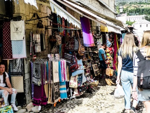
Dining and shopping on the main street
We parked on the western side of the Neretva River, a short walk from the famous bridge. Here stands a huge Catholic cathedral, Mary Mother of God. The walk towards the bridge is vibrant with lively souvenir shops and lots of tourists. Once again, The Bosnian Catholics, Moslems and Orthodox Christians got together in 1995 and peace was restored since then. On one side of bridge stands a Catholic church. Across the bridge, one can see minarets. The bridge is a sign of reconciliation.
Peoples of different religions lived together in harmony, even if the Western side of the river are Christians and the Eastern side are Muslims. But the Balkan War disrupted this peace. Neighbors and friends warred against each other. Mostar was the worst devastated city during the Bosnian war. There are still scars in the city, like these bullet holes along a restaurant and a badly dilapidated building.
From Mostar, we traveled 4 hours to Trebinje, where we lodged at Hotel Leotar, a 3-star at most. The prepaid meal (10 euro) was just fish, rice and a banana, and was not worth the price. Lucky for us that this was the only hotel did not live up to its brand as a 4-star.
Catholic and Muslim places of worship together on the road to reconciliation.
Scars of war remain
"One for the road" to Trebinje. Živjeli! (Cheers!)
3. CROATIA (Hrvatska)
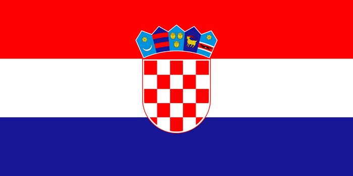
Symbolisms in the Croatian Flag: White for peace and unity; Red for sacrifice; and Blue for freedom and hope. The checkered red and white squares are at the very center. On top of these squares represent the 5 historical regions: Croatia Proper, Dubrovnik, Dalmatia (where the Dalmatian dogs reportedly originated), Istira, and Slavonia (not to be confused with the country Slovenia). The border countries are Slovenia, Hungary, Serbia and Bosnia and Montenegro. It has over a thousand islands on the Adriatic Sea, although only 50 of them are inhabited.
Croatia is located on the western part of the Balkan Peninsula. While it has in own national language, Croatians understand the languages of the other Slavic countries such as Bosnia, Serbia and Macedonia. As mentioned earlier, the difference is that Croatia and Bosnia use the Latin alphabet and Serbia and Macedonia use the Cyrillic alphabet.
Let’s look into some interesting facts about this country.
1. You can
buy a castle with USD1.5M. Look it up!
2. Popular movies filmed in Croatia–
Game of Thrones, The Last Jedi, Robin Hood and Mama Mia
3. Ranked one of
safest countries for tourists in the world
4. Croatia is one of the most
popular tourist destinations in the world; the cruise ships come in droves.
Friends who have been in cruises always say it’s a place to go.
5. Necktie –
was the originator and was first used by their military in the 17th century; it
is the Guinness record holder of the longest necktie (2,650 ft)
6. Dalmatian
dogs originally came from historical region of Dalmatia
7. Currency (kuna) is
named after an animal looking like a beaver.
8. It is a small country that
has 7 UNESCO sites
9. Don’t’ go there in July and August. These are the
hottest months.
10. Primarily known for its coast, it has also scenic inland
view. The Dinaric Alps separate Croatia from Bosnia. It has a wide range of
wildlife and beautiful sceneries such as caves, waterfalls, and forests.
11.
Its history dates back to the migration of the Illyrians, then became part of
the Roman Empire. Then was a kingdom within the Austro Hungarian Empire. It got
engaged with wars with Turkey, then was overran by the Nazi, and got involved in
the Balkan Wars and suffered a Civil War. It is now part of the EU.
12. In
spite of these, it is one of 30 countries experiencing population decline from
4.5 million.
13. They are predominantly Roman Catholics. They have a claim
on Nicola Tesla, although he is of Serbian descent. It is very much aligned with
other Catholic countries like Poland, Italy, Ireland and Spain. But they like to
do business with Germany.
14. In 2018, Croatia got into the World Cup finals
– their first.
3.1 Dubrovnik
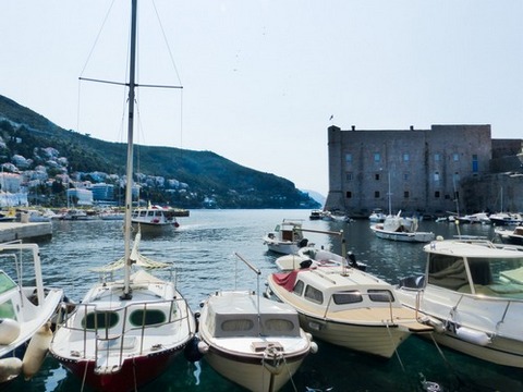
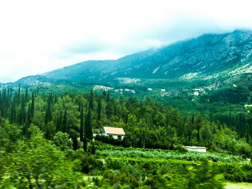
Photos below show the most breathtaking coastline scenes on our way to
Dubrovnik, the southernmost city of Croatia.
To read about Zagreb, the country’s capital, please click on
"The Balkans:
“Pre-Tour”
by Norman Bituin.
The major
coastal city Dubrovnik has a striking mountain backdrop and massive 16th-century walls encircling an Old Town
with Gothic and Renaissance buildings.
It has a hard fought
history of wars. It was major power in the past. In ancient times, Greeks and
Romans sailed on the coastline. Some structures were built by Venetians. Its
imposing architecture is a reminder of its old glory. The salt trade was rival
to Venice. Its Golden Age was in the 15th century, combining architecture of
Renaissance and Venetian Gothic style.
It is said that the
promenade inside the walls is the heartbeat of the city but one should walk into
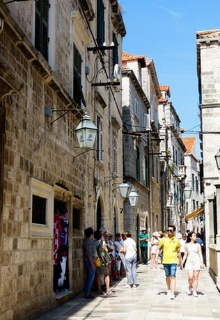
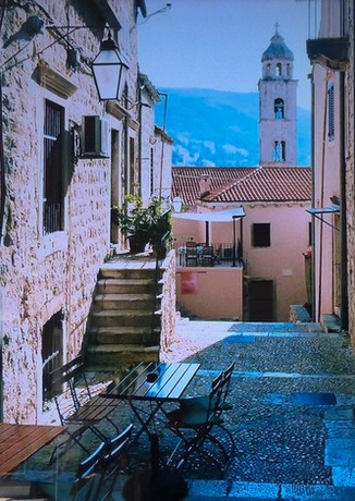
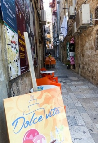
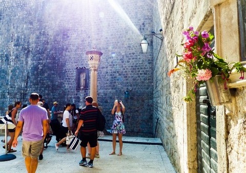
the backstreets to see its charm and also to buy things at much lesser price. A big attraction is
its mighty wall. They charge 15 euro to go around it, so Norman and I decided to
just enjoy the side streets instead.
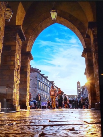
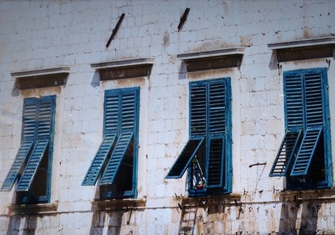
The side entrance; and people line up to buy tickets (15 euro) to go up the fortress.
We enjoyed walking the side streets instead.
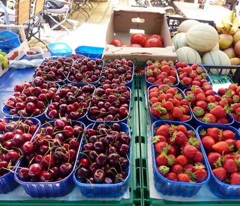
Dubrovnik was a major maritime power 500
years ago, with the third-biggest navy in the Mediterranean. Still projecting
confidently into the sea and ringed by thick medieval walls, Dubrovnik is also
called the Pearl of the Adriatic. Within the walls one beholds the traffic-free
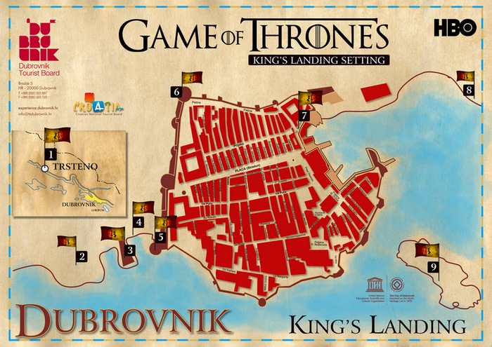
Old Town comprised of steep alleys, museums (there is a Game of Thrones building
entrance), al fresco cafés, farmers’ market type stalls, and squares where kids
can enjoy. After all these centuries, the buildings still hint at old-time
wealth, and the central promenade remains the place to see and be seen.
The fortress was built in the 1400 a defense against the Ottoman Turks. This might as well be Europe’s finest fortified city. Dubrovnik is a living fairy tale. The Game of Thrones was filmed here. In fact, one of the main tours being offered features this popular TV series.
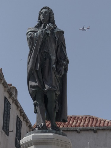
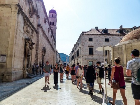
Once we got to Pile Gate (the fort’s main entrance), we walked into the
streets of the Old Town. The main street Stradun that ends on a building with a
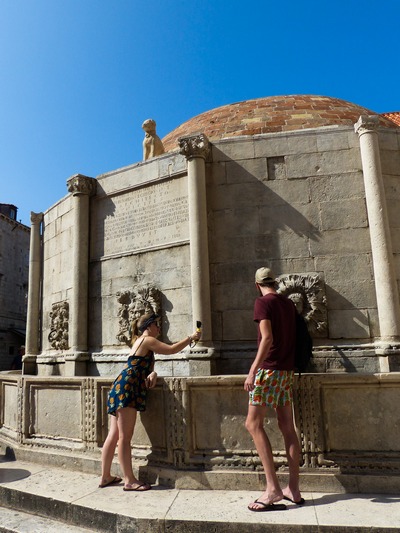
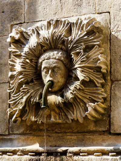
bell tower and a fountain. Many
people refresh themselves at Onofrio’s Fountain, then pay respects at Saviour
Church.
At the Stradun’s eastern end Luza Square,
Sponza Palace and Saint Blaise Church, which honors the city’s protector. Legend
has it that St. Blaise appeared in a vision in 971 to warn Dubrovnik of an
impending Venetian invasion.
The Assumption Cathedral is the
seat of the Diocese of Dubrovnik. The cathedral was built on the site of several
former cathedrals, including 7th, 10th and 11th century buildings, and their
12th century successor is in the Romanesque style. The money to build the
basilica was partially contributed by the English king Richard the Lion Heart,
as a thanksgiving for having survived a shipwreck on his return from the Third
Crusade. It is considered as the greatest cathedral in the Adriatic. Montenegrin
shells rained down in the 1990s war of independence.
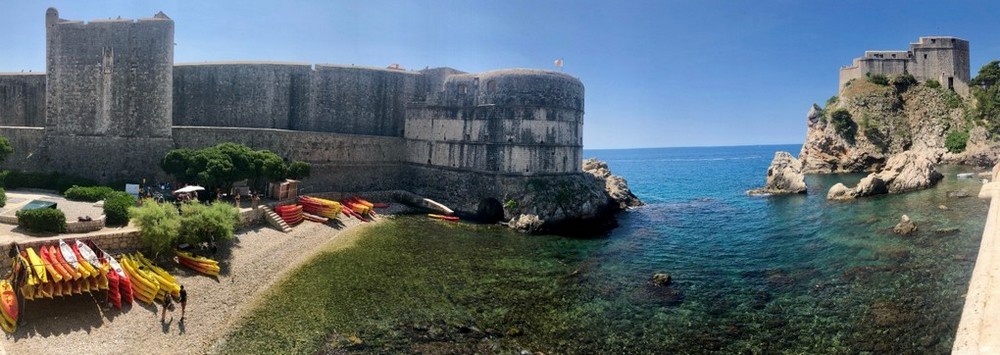
Overlooking Bokar Tower and Fort Lawrence is also known as the “Gibraltar of Dubrovnik”. This was built to repulse the attack by Venetians and also protected the city from pirates.
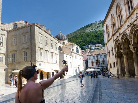
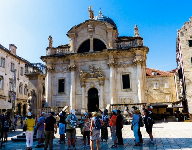
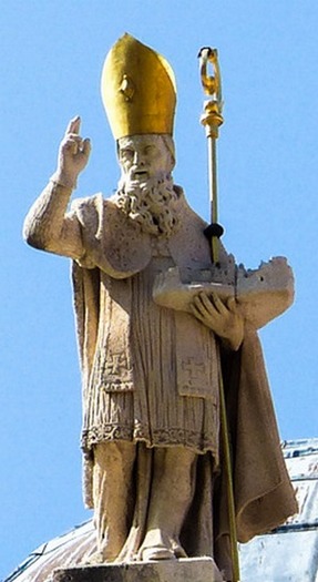
St. Blaise Church was constructed in 1715 in the Venetian Baroque Style by the Venetian master Marino Gropelli. St. Blaise is the patron saint of Dubrovnik.
Dubrovnik Cathedral of the Assumption of the Virgin Mary was destroyed in the earthquake of 1667 and rebuilt in 1713 in the Baroque style.
Among the relics enshrined are the arms, skull and leg of St. Blaise, all plated in gold. Cathedral contains a rich treasury, including paintings from top masters like Titian.
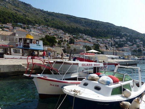
Bokar Tower and Fort Lawrence
We then set out for another scenic drive towards Montenegro.
4. MONTENEGRO
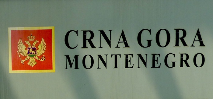
Montenegro was part the Byzantine Empire, then under
control of the control of the Ottoman Empire in the ensuing centuries. It became
a part of the Kingdom of Yugoslavia in 1918, which was succeeded by the Federal
People's Republic of Yugoslavia in 1945.
After the breakup of Yugoslavia in
1992, the republics of Serbia and Montenegro together established a federation
as the Federal Republic of Yugoslavia. In 2003, it renamed itself Serbia and
Montenegro. A referendum held in 2006 declared independence and officially named
itself Republic of Montenegro.
It is classified by
the World Bank as an upper middle-income country, Montenegro is a member of the
UN, NATO, the World Trade Organization, the Organization for Security and
Co-operation in Europe, the Council of Europe and the Central European Free
Trade Agreement and a founding member of the Union for the Mediterranean.
It
has a coast on the Adriatic Sea to the southwest and is bordered by Croatia to
the west, Bosnia and Herzegovina to the northwest, Serbia to the northeast,
Kosovo to the east and Albania to the southeast. Its capital is Podgorica.
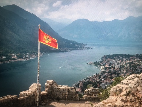
Montenegro, meaning “Black Mountain”, is a land of nature with rugged mountains,
medieval villages and a narrow strip of beaches along its Adriatic coastline.
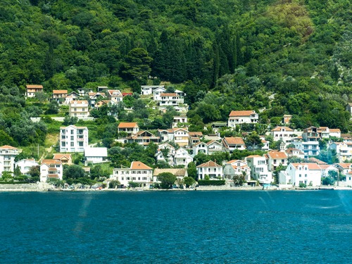
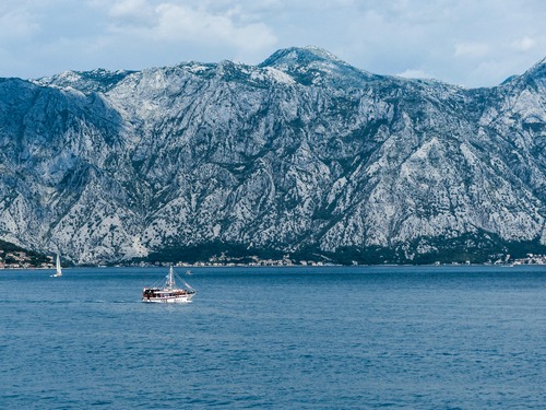
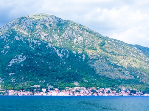
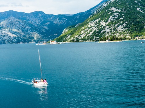
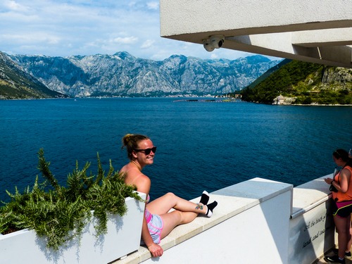
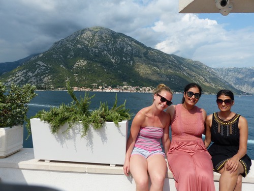
The sites towards our destination are equally breathtaking with all the fjords,
mountains and islets.
4.1 Kotor
The Bay of
Kotor, resembling a fjord, is marked with coastal churches and fortified towns.
It is where towering mountains meet the Adriatic. A country of contrast, one can
see communist era buildings and beautiful seascape where one could see
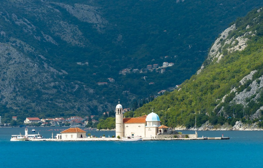
fjord-like cliffs along the Adriatic. We were supposed to go to a man-made
island (our Lady of the Rocks) except for a very long wait at the border. We
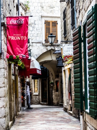
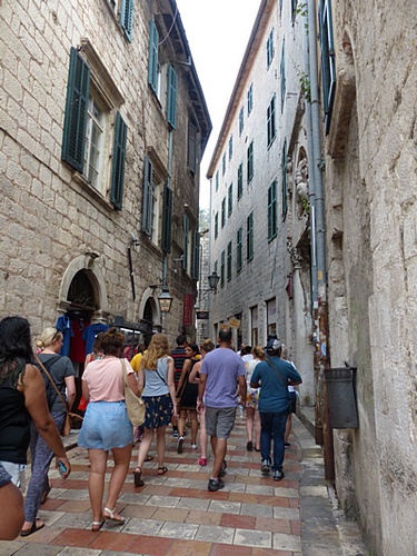
made a short visit at Kotor, a city with imposing walls. Its main square are
busy with cafes where Norman and I shared a pizza for lunch.
Located on a beautiful bay on the coast of Montenegro, Kotor is a city
immersed in tradition and history, with remarkable scenic views. A UNESCO World
Heritage site, the old city was built between the 12th and 14th centuries and is
filled with medieval architecture and historic monuments. Extending over four
kilometers, the city walls that have protected Kotor for centuries lead up to
the fortress of Saint Ivan.
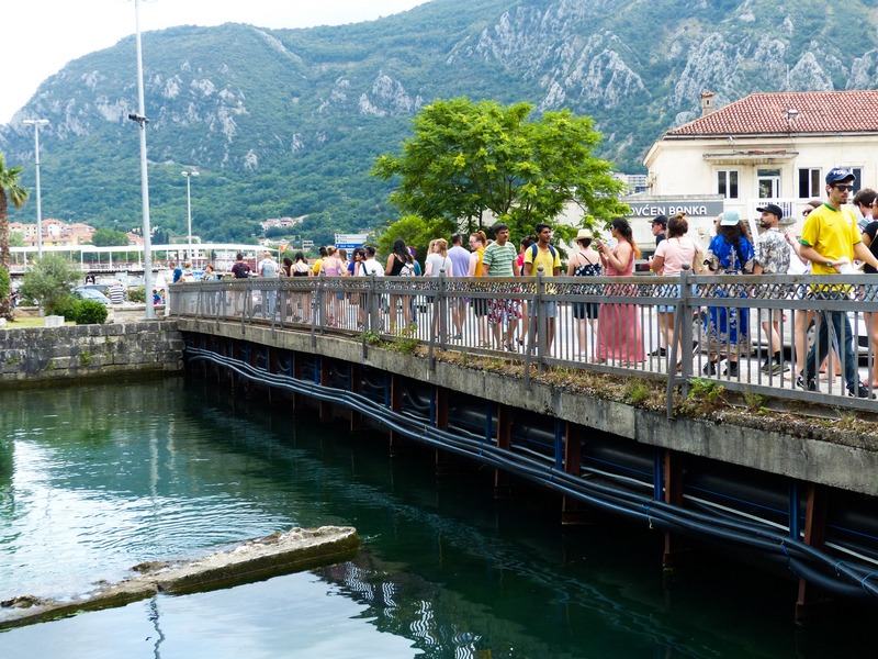
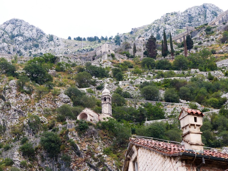
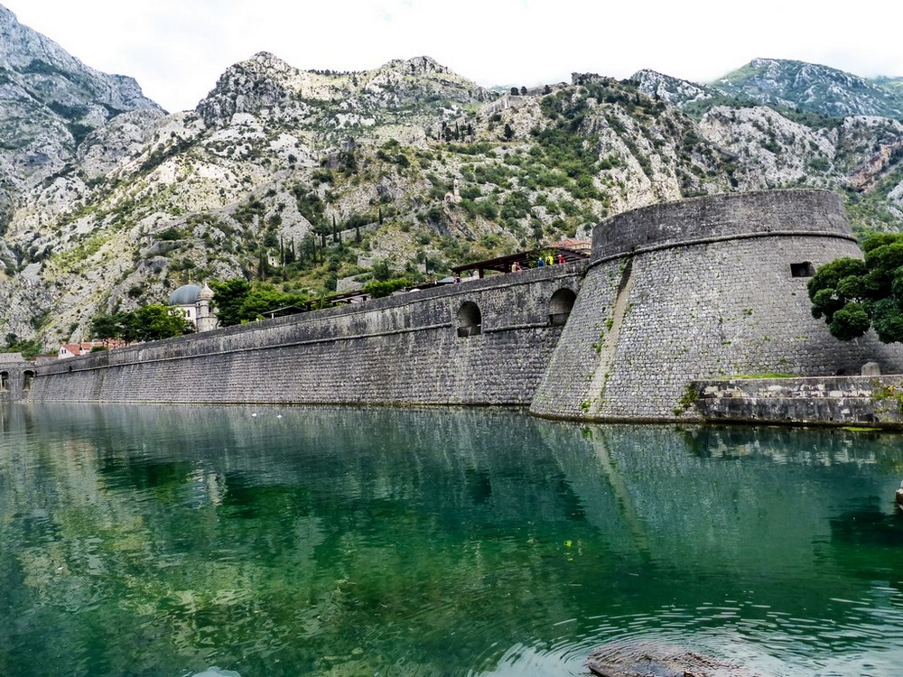
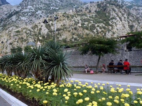
Kotor was founded during the
Roman era in168 BC. The town has been fortified since the early Middle Ages,
when Emperor Justinian built a fortress in 535, after expelling the Ostrogoths.
It was further fortified towards the peak of Saint Ivan in 10th century. It was
one of the more influential Dalmatian city-states of Romanized Illyrians
throughout the early Middle Ages. Until the 11th century the Dalmatian language
was still spoken in Kotor.
The city was part of the Venetian Albania
province of the Venetian Republic from 1420 to 1797. It was besieged by the
Ottomans in 1538 and 1657. Four centuries of Venetian domination have given the
city the typical Venetian architecture, that contributes to make Kotor a UNESCO
world heritage site.
Under Venetian rule, Kotor was besieged by the
Ottoman Empire in 1538 and 1657, endured the plague in 1572, and was nearly
destroyed by earthquakes in 1563 and 1667. It was also ruled by Ottomans at
brief periods.
The Cathedral of Saint Tryphon is one
of two Roman Catholic cathedrals in Montenegro. It is the seat of the Catholic
Bishopric of Kotor which covers the entire gulf. Kotor is one of the best
preserved and most beautiful medieval fortified towns in the Mediterranean. It
was built in honor of Saint Tryphon, the patron and protector of the city.
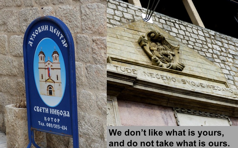
Kotor Gate
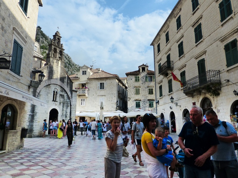
Main Square
Cathedral of Saint Tryphon was consecrated in 1166.
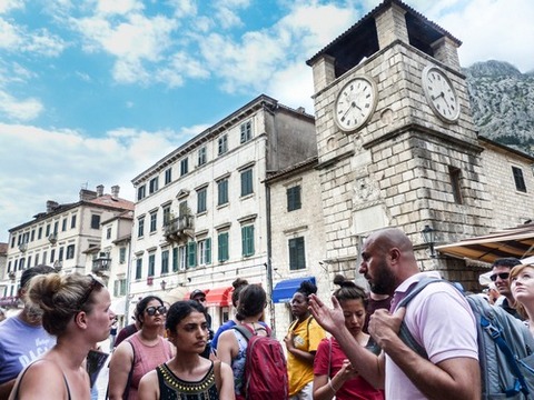
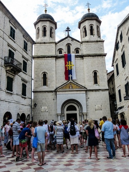
Saint Nicholas Church is Serbian Orthodox built in 1902-1909.
4.2 Budva
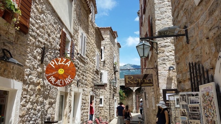
The main attraction of Budva is its charming Old Town (Stari Grad). The
town is believed to be some two and a half millennia old. Much of its
architecture dates from the period of Venetian occupation (1420 to 1797). It was
they who fortified it with strong defensive walls.
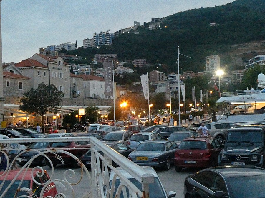
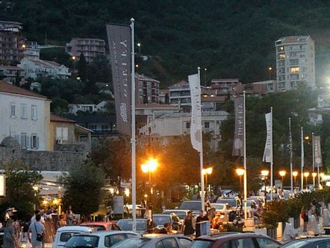
Budva
has around 15,000 inhabitants. The coastal area around Budva, called the
Budvanska Rivijera, is the center of Montenegro's tourism, and is well known for
its sandy beaches, diverse nightlife, and examples of Mediterranean
architecture.
Budva is 2,500 years old, which
makes it one of the oldest settlements on the Adriatic sea coast. The vast
archaeological evidence dating back to the 5th century BC places Budva among the
oldest urban settlements of the Adriatic coast.
Two
other civilizations also left innumerable traces: the Greek and the Roman. Upon
the fall of the Roman empire and its division into east and west, the defensive
barrier which separated the two powers happened to run across this area,
subsequently making a lasting impact on the history and culture of this town. In
the Middle Ages, Budva was reigned by a succession of Diocletian kings, Serbian
and Zetan aristocrats.
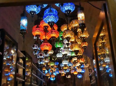
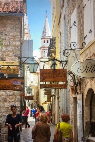
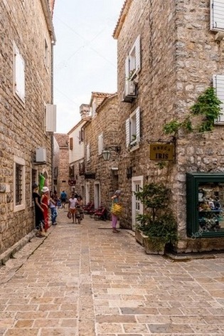
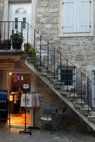
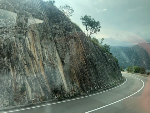
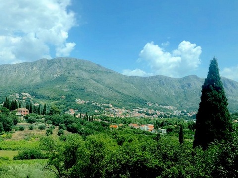
We drove around the beautiful Montenegro coast on the way to Albania.
 `
`


=======================
NOTE: DEAR READER, I will be writing about PART
TWO later. This will be about the four other countries in our itinerary, namely:
Albania, Macedonia, Bulgaria and Romania. And here’s an assurance: These
countries are equally interesting and you will certainly enjoy the photographs.